APPLICATIONS
FROM RAW DATA TO SMART SYSTEMS
Bridging radar science and operational technology.
Our custom tech solutions turn radar and geospatial data into actionable workflows. With seamless integration, automation, and precision at the core, we empower industries to monitor, analyze, and respond—smarter and faster.

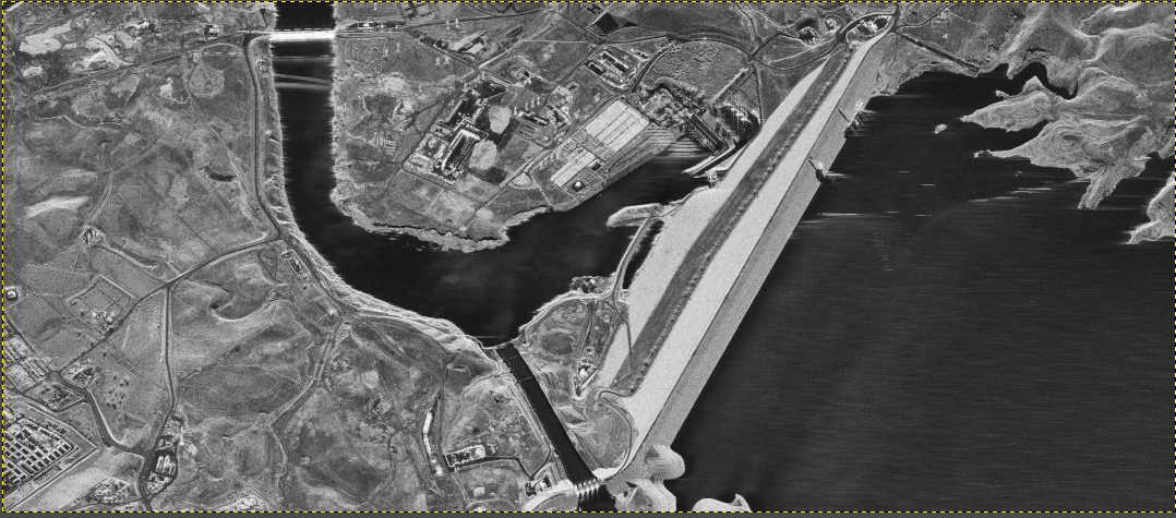
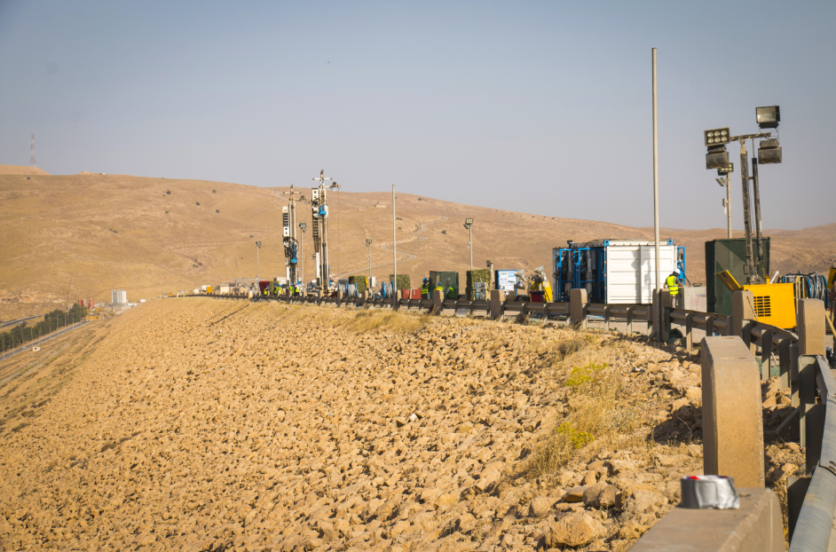
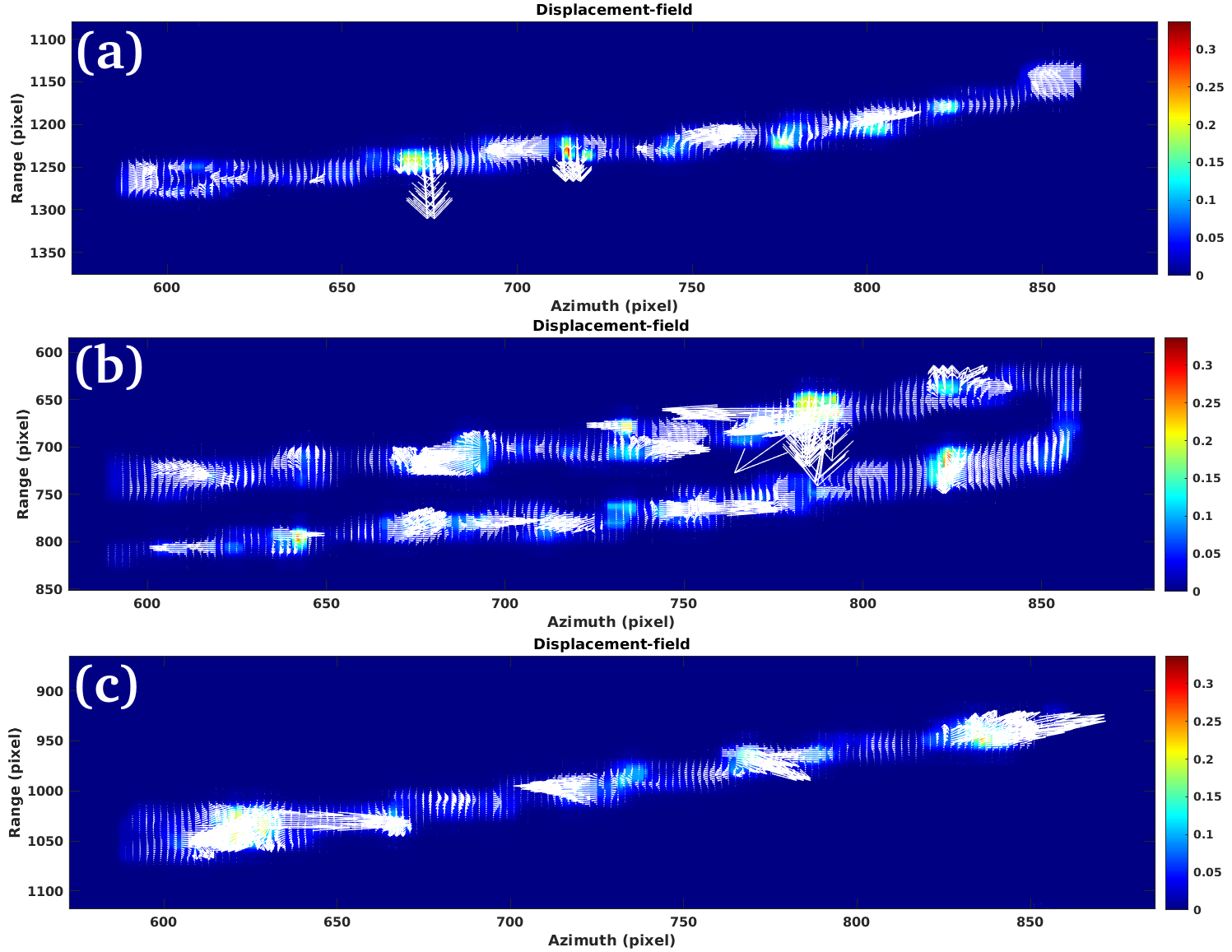
Infrastructure Stability & Structural Monitoring
Critical infrastructure such as bridges, railways, dams, and tunnels is constantly exposed to stress, environmental shifts, and ground movements. Undetected deformation—even in the range of a few millimeters—can compromise structural integrity, safety, and long-term operational reliability.
Through advanced radar technologies like InSAR and DInSAR, we monitor infrastructure assets remotely and continuously, without any physical installation on site. Our systems detect subtle ground or structural displacements, providing early indicators of risk and supporting predictive maintenance strategies for both public and private sector stakeholders.


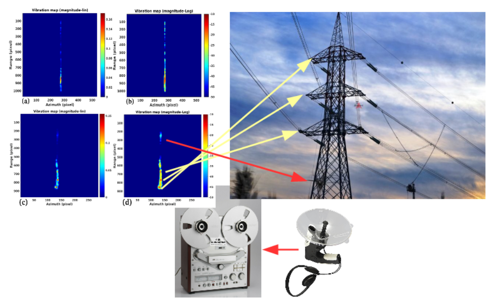
Energy Asset Monitoring & Ground Stability
Energy infrastructure—such as pipelines, power plants, wind farms, and solar fields—often extends across vast, remote, or geologically unstable areas. Ground movements, subsidence, or seismic activity can silently undermine the structural integrity of these assets, increasing the risk of failure or environmental damage.
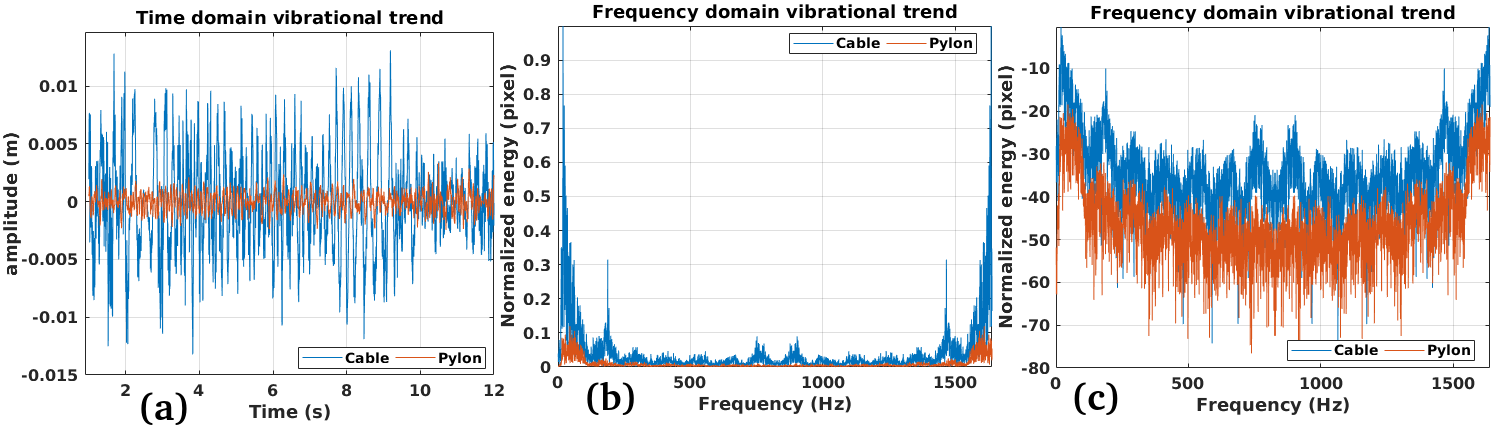
Using advanced radar techniques like DInSAR and harmonic SAR tomography, we provide continuous, large-scale monitoring of terrain and structural foundations. Our approach enables early detection of shifts and stress zones around critical energy assets, enhancing operational safety, reducing maintenance costs, and supporting regulatory compliance.
Environmental Risk Detection & Terrain Evolution
Natural landscapes are constantly shaped by processes like erosion, landslides, coastal retreat, and tectonic movement. These transformations, often slow and imperceptible, can suddenly escalate into major environmental hazards—putting ecosystems, infrastructure, and communities at risk.
With technologies such as InSAR, DInSAR, and amplitude change analysis, we monitor large natural areas to detect early signs of ground instability. Our data supports land planning, conservation efforts, and disaster prevention strategies by identifying active zones and long-term terrain evolution with sub-centimetric precision.


Agricultural Land Monitoring & Soil Stability
Agricultural zones are highly sensitive to subsidence, excessive irrigation, seasonal variations, and underground water extraction. These factors can alter soil structure, reduce productivity, or even trigger long-term land degradation.
Using radar-based technologies like InSAR and multi-temporal SAR analysis, we provide wide-area monitoring of farmland and rural environments. Our solutions help detect ground deformation, assess irrigation impacts, and support sustainable land use strategies—enabling governments, cooperatives, and agribusinesses to make informed decisions grounded in data.
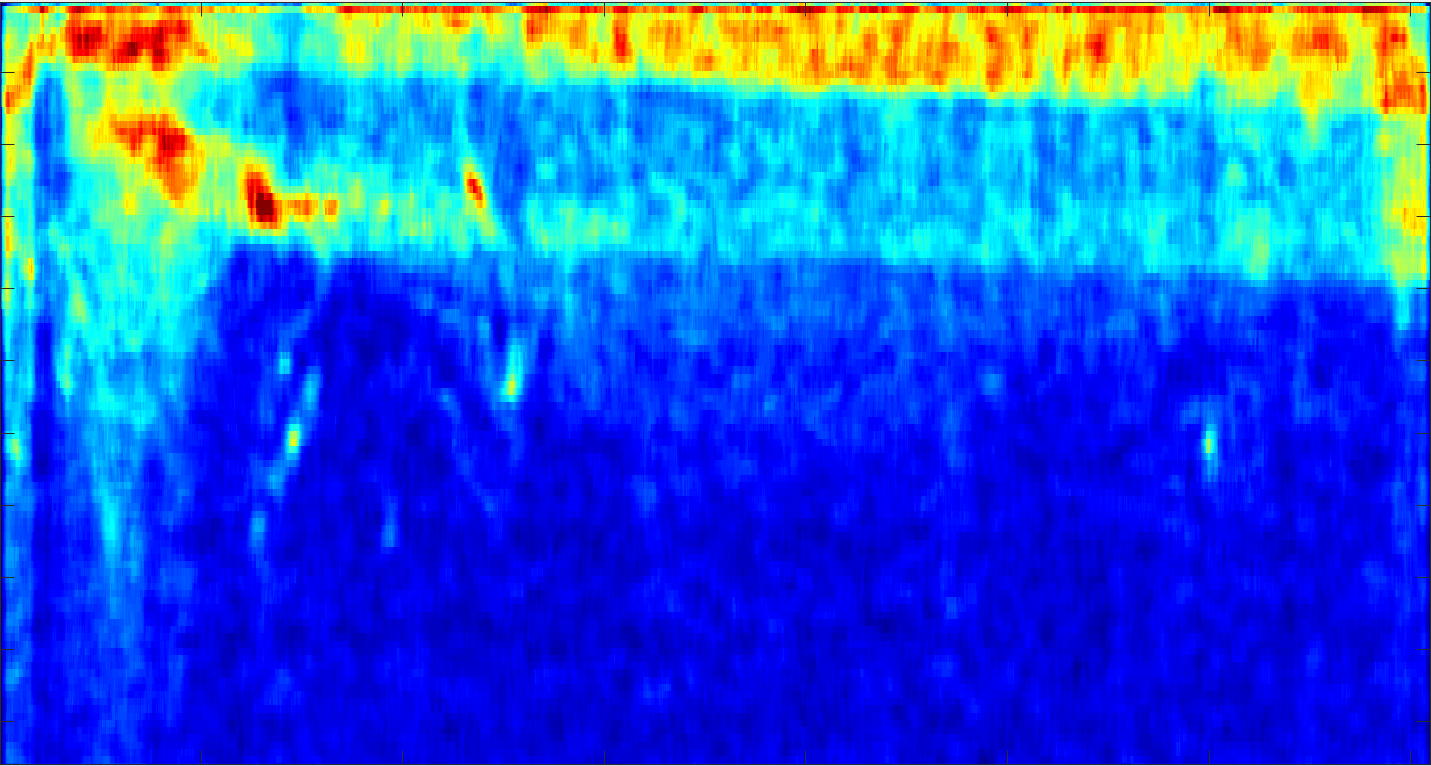
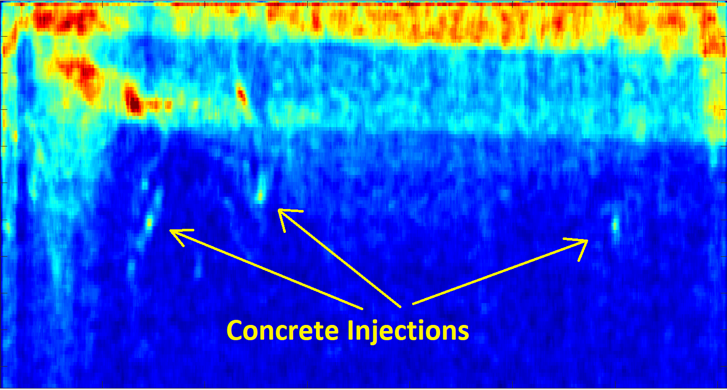
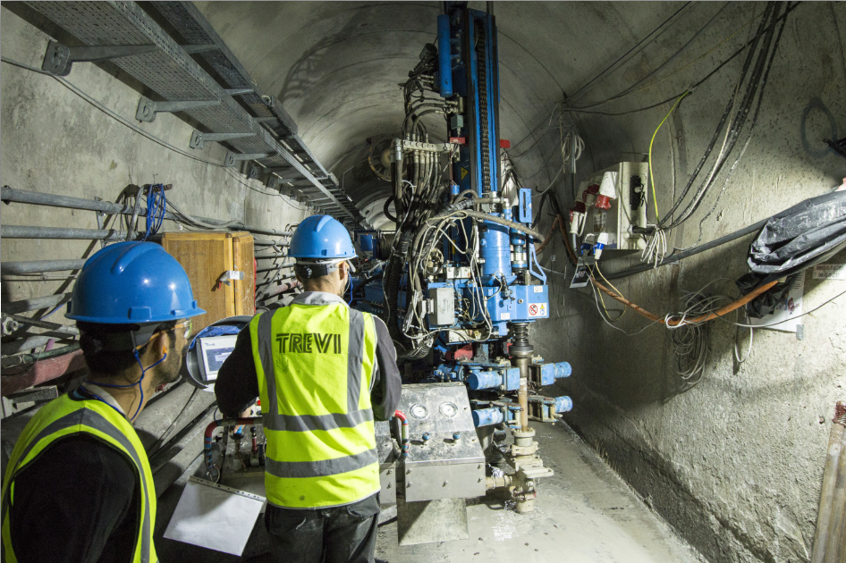
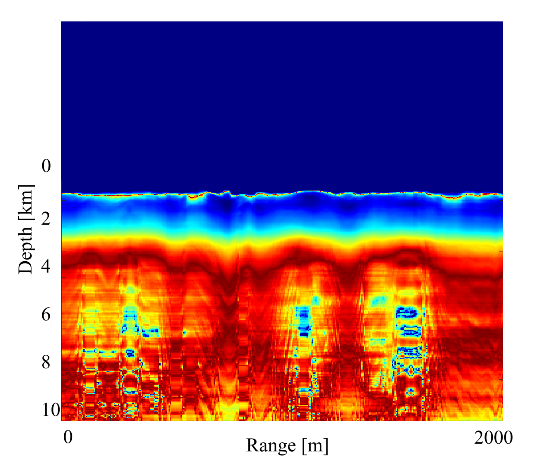
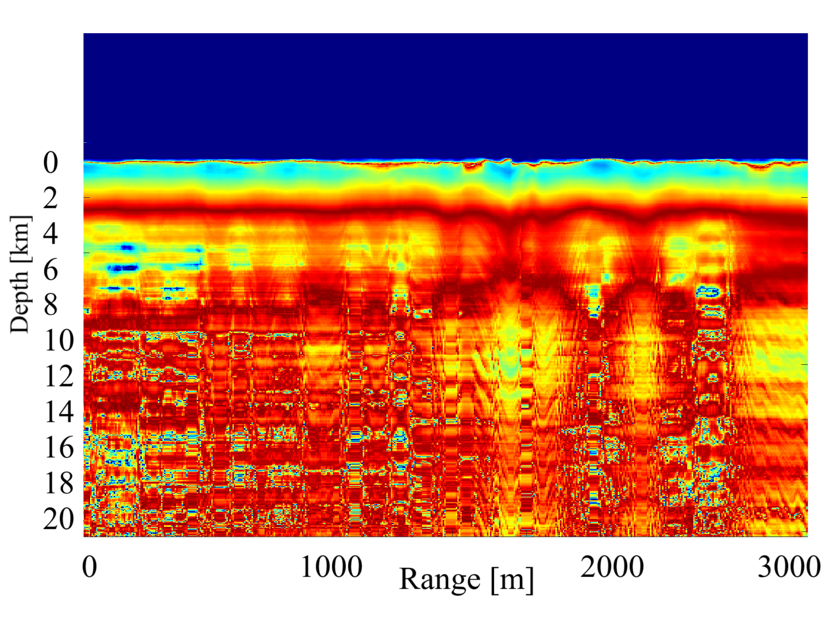
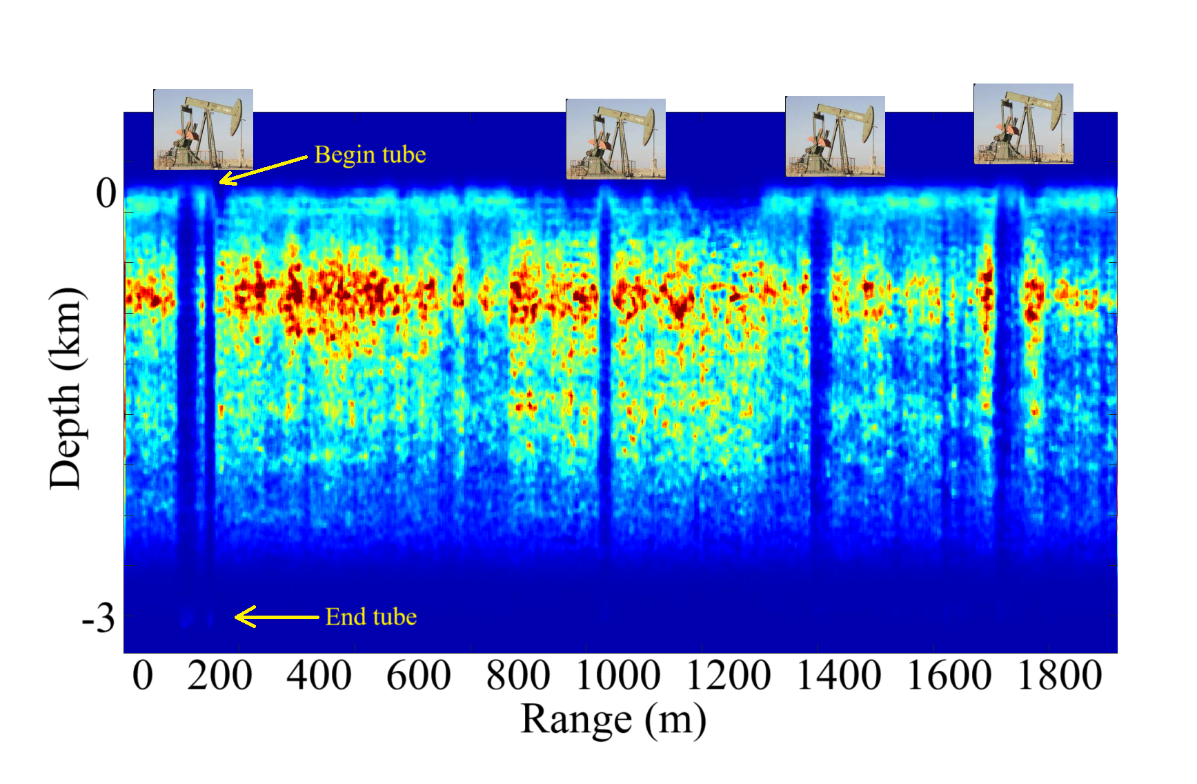
Subsurface Monitoring for Oil & Gas Fields and Infrastructure
Oil and gas operations—ranging from exploratory drilling and production wells to pipeline corridors and storage sites—are highly sensitive to subsurface changes. Activities such as fluid injection, gas extraction, and fracking can cause localized deformation, subsidence, or induced seismicity, often with limited surface indicators.
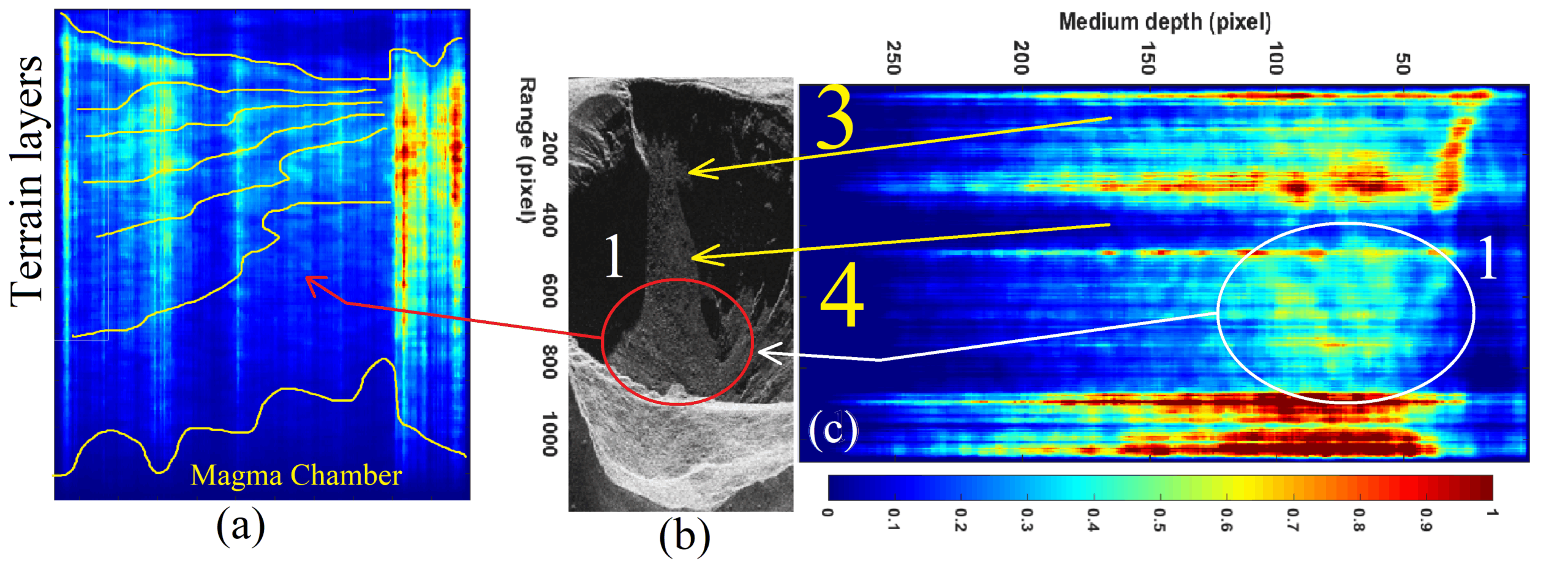
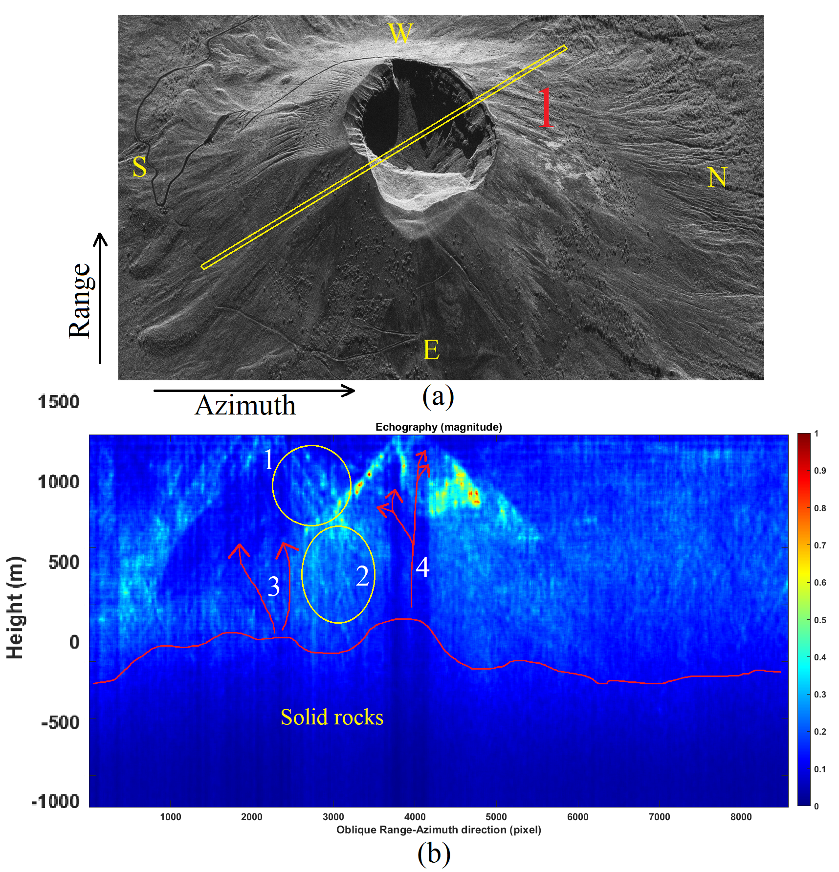
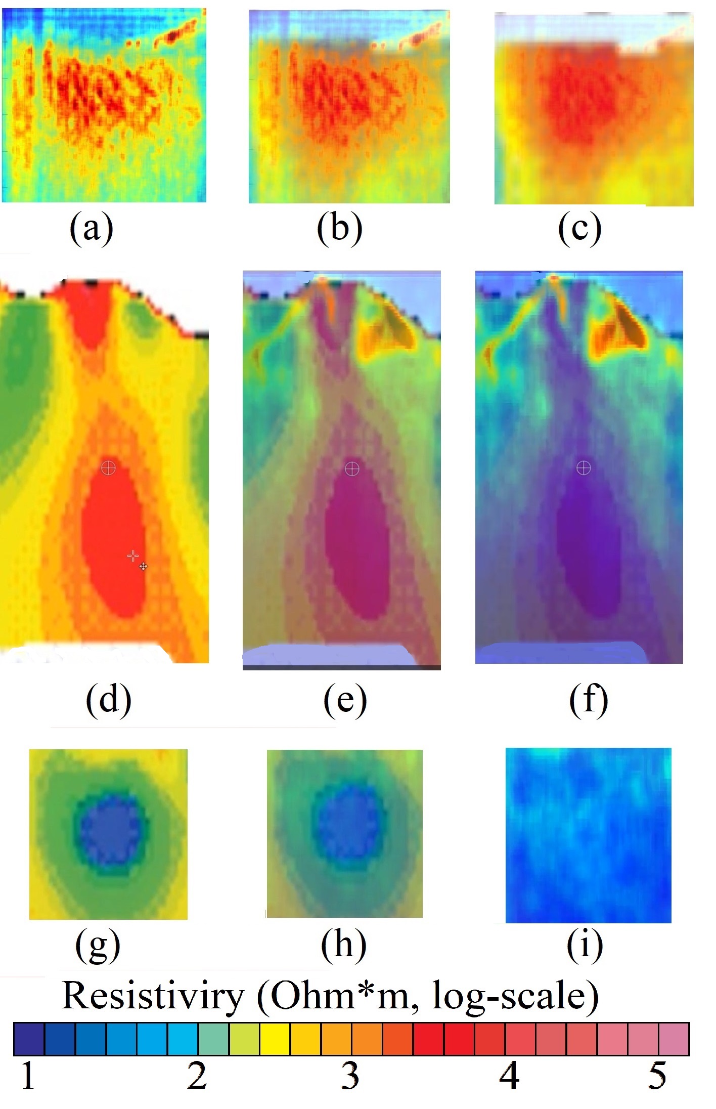
At CORE Engineering, we apply advanced radar-based technologies like DInSAR and subsurface tomography to detect micro-movements before they escalate. Our systems deliver high-resolution insight into terrain dynamics around well pads, drill rigs, injection fields, and critical infrastructure, allowing operators to monitor stress accumulation, prevent casing failure, and mitigate environmental risks.
Whether upstream or downstream, our technology supports predictive maintenance, regulatory reporting, and real-time decision-making across complex geologies and production zones.
")

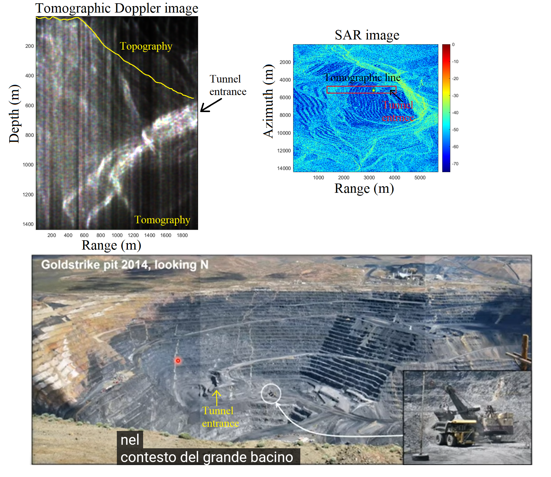
Mining Deformation Monitoring & Terrain Stability
Mineral extraction, especially in open-pit and underground mines, exposes terrain to significant structural stress. Slopes can fail without warning, and subsurface voids may evolve into hazardous ground collapses—risking worker safety and costly production halts.
Using technologies like InSAR, DInSAR, and harmonic SAR tomography, we detect even millimetric surface displacements across active mining areas. Our solutions allow for continuous, remote observation of slope movement, bench deformation, and terrain compaction—enabling operators to plan excavation safely, prevent slope failure, and comply with geotechnical regulations.
Tailored Geospatial Solutions for Specialized Needs
Some challenges require a custom approach. Whether you’re a government agency, an engineering firm, or a private operator managing complex terrain, we design radar-based monitoring systems that adapt to your operational goals, constraints, and geographical context.
From one-time assessments to long-term observation strategies, we deliver flexible, scalable solutions powered by SAR, InSAR, and proprietary tomography. Our team supports the entire process—from design and calibration to analysis and actionable reporting—ensuring precision, reliability, and strategic value across any domain.

